
About This Park
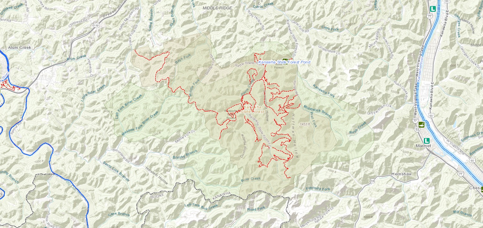
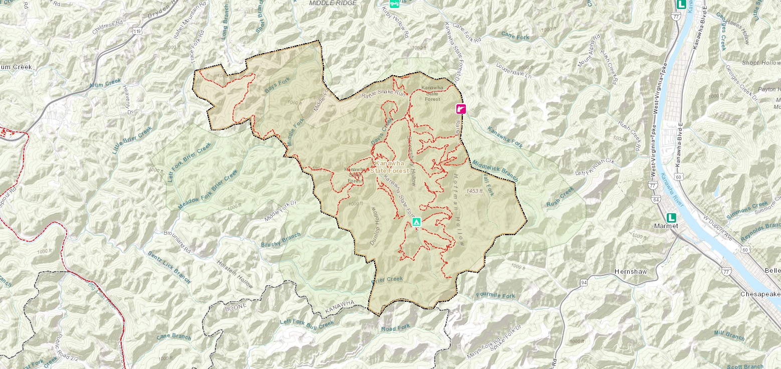
Located seven miles from Charleston, Kanawha State Forest is a popular destination for outdoor enthusiasts. The forest has more than 60 miles of hiking and biking trails, picnic areas and diverse wildflower, tree and bird populations. Amenities include picnic shelters, playgrounds and camp sites. In-season hunting is permitted in specified areas for hunters with a valid license.
Accommodations
Select an option below to learn more about the accommodations at this park.Activities
Select an activity below to learn more-
Biking
Biking
Kanawha State Forest offers biking opportunities for all skill levels. With 33 trails totaling 45 miles permitting bike use, along with an additional 35 miles of improved and unimproved roads, Kanawha State Forest is a riders’ paradise. All classes of e-bikes are permitted on any trails or roads where mountain biking is permitted.
-
Camping
Camping
Kanawha State Forest now offers year-round camping. The campground consists of 46 sites: 25 with water and electric hookups, 9 with electric only, and 12 primitive sites, with electric services now ranging from 30-50amp. Each campsite has a fire ring with a grill and picnic table. The campground has two bathhouses, one of which may be subject to seasonal closure, and coin-operated laundry services. RVs or trailer/truck units longer than 26 feet are not recommended.
-
Fishing
Fishing
Thanks to the reconfiguring of Davis Creek, with the removal of a small dam, this fishing stream flows more naturally, creating a better experience for everyone. The recently completed Davis Creek restoration project includes the installation of two new wheelchair-accessible fishing piers to facilitate Class Q fishing.
Davis Creek in Kanawha State Forest is a Class Q stocking location, receiving one trout stocking the first week of March. Fishing in Kanawha State Forest is limited to Class Q license holders and youth 14 and under from March 1st through May 31st.
To learn more about fishing in West Virginia, visit WVdnr.gov.
Fishing in Kanawha State Forest
-
Geocaching
Geocaching
Hunt through the park to find 5 cache sites before someone else beats you to the treasure! Join in on geocaching, the technological scavenger hunt. All you need is an adventurous spirit and a smartphone with GPS.
-
Hiking
Hiking
Kanawha State Forest has more than 60 miles of trails for every level of hiker. Naturalists regularly lead guided hikes and wildlife programs for visitors. Kanawha State Forest offers “The Spotted Salamander” trail, a paved, level walkway with braille interpretive nature stations designed for both visually impaired and physically challenged guests.
Download Park Pack & Map -
Horseback Riding
Horseback Riding
Live in moments that matter. Experience the beauty of running streams and creeks, hills, and towering trees from horse-back at Kanawha State Forest’s newly renovated stables. Leased and operated by Circle B Stables, horse related activities including guided trail rides, pony rides, birthday parties, classes, field trips and more are now available. Circle B Stables is open Thursday – Sunday (Thursdays by reservation only) from Memorial Day through Labor Day and Friday – Sunday in April, May, September, and October. Hours of operation are 10am-6pm with final rides beginning at 5pm. Walk-ins are welcome but reservations are strongly encouraged. Circle B Stables (304) 558-1015, (304) 963-2192, circlebstable@outlook.com.
-
Hunting
Hunting
Hunters are welcome in season and in specified areas. Licenses are available online if you don’t have one. No-hunting zones surround all forest recreational facilities.
Hunting in Kanawha State Forest
-
Museums & Historical Sites
Museums & Historical Sites
West Virginia State Capitol Complex
The Capitol grounds include the Culture Center which houses an art museum and the State Museum of West Virginia. West Virginia Public Radio’s “Mountain Stage with Larry Groce” is recorded at the Culture Center Theater.
Capitol Market
A collection of vendors carries a variety of items including fresh produce, plants and flowers, handmade and homemade West Virginia products, wine and beer, and fresh seafood and meats. Soho’s Italian Restaurant is located here.
The Clay Center for the Arts and Sciences
The Clay Center includes a performance hall, art museum, science exhibits and the Electric Sky Theater, which doubles as a planetarium and movie theater.
-
Outdoor Adventures
Outdoor Adventures
Kanawha State Forest has plenty of outdoor adventure to offer! There’s several children’s playgrounds located throughout the forest and in the various picnic areas for your little ones to play.
The shooting range provides covered shooting stalls for convenience of users. Only paper targets are allowed. The forest range is free to the public for use and open during daylight hours and subject to closure for maintenance.
The archery range, located approximately 2 miles from the forest entrance in Loudendale, provides targets at 30 and 60 yards. Practice points only. The archery range is free and open to the public from 8 a.m. to sunset.
The stables at Kanawha State Forest is operated by Circle B Stables. Find more information, hours of operation, and how to book horseback rides in our Additional Information section on our webpage.
Contact
- Phone: 304-558-3500
- Email: kanawhasf@wv.gov
- Address: 7500 Kanawha State Forest Dr, Charleston, WV 25314
History
The land that is now Kanawha State Forest originally was the site of extensive mining and logging. In 1937, the West Virginia Conservation Commission purchased 6,705 acres on the headwaters of Davis Creek outside of Charleston. The following year, Camp Kanawha was set up as a project of the Civilian Conservation Corps. The CCC removed coal tipples and other structures no longer in use and built roads, the superintendent’s residence and picnic shelters. A dam also was built across Davis Creek to create a small lake. [Learn more about Davis Creek Dam here.] After Camp Kanawha’s closure in 1942, the state acquired an additional 2,500 acres. The Kanawha State Forest Historic District was listed on the National Register of Historic Places in 1993.
Camping
Kanawha State Forest’s campground includes 44 sites, 25 of which have electricity and water hookups. Each campsite has a fireplace and picnic table. The campground has two bathhouses and a coin-operated laundry. RVs or trailer/truck units longer than 26 feet are not recommended. The campground is open April through December.
Trails Foot traffic only
Download Park Trail Map#1 Store Trail
Alligator Rock Trail
Beech Glen Trail
CCC Snipe Trail
Hemlock Falls Trail
Johnson Hollow Trail
Lindy Trail
Logtown Trail
Overlook Rock Trail
Polly Trail
Rattlesnake Trail
Rocky Ridge Trail
Spotted Salamander Trail
White Hollow Trail
Trails Mountain bikes permitted
Download Park Trail MapBallard Trail
Black Bear Mountain Bike Trail
Davis Creek Trail
Mossy Rock Trail
Pigeon Roost Trail
Pine Ridge Trail to Dunlop Trail
Polecat Trail
Teaberry Rock Trail
Wildcat Ridge Trail
Additional Information
Circle B Stables at Kanawha State Forest
Experience the beauty of Kanawha State Forest by horseback.
Leased and operated by Circle B Stables, all activities including guided trail rides, pony rides, birthday parties, classes, field trips and more are now available!
Circle B Stables is open Thursday – Sunday (Thursdays by reservation only) from Memorial Day through Labor Day and Friday – Sunday in April, May, September, and October. Hours of operation are 10am-6pm with final rides beginning at 5pm. Walk-ins are welcome but reservations are strongly encouraged. Circle B Stables (304) 558-1015, (304) 963-2192, circlebstable@outlook.com.”
Shooting Range
A covered shooting range is open daily and is free to the public with only paper targets allowed. The range is open during daylight hours and subject to closure for maintenance.
The range at Kanawha State Forest closes the first Monday of each month for maintenance. If the first Monday of the month falls on a holiday, range maintenance will occur on the second Monday of that month. Range notifications such as additional clean up days, repairs, etc., are frequently posted by the Kanawha State Forest Foundation on the Facebook page, KSSFoundation.
Paper, clay, and tin targets are allowed. Skeet and trap style shooting is prohibited. Range hours are 8:00AM – 8:00PM from May 1 through September 30 and 8:00AM to 6:00PM, October 1 through April 30.
Picnicking
The forest has numerous picnic sites with tables, grills and nearby restroom facilities. Nine picnic shelters are available to rent for a nominal fee; advance reservations are recommended for large groups.
Nearby Attractions
West Virginia State Capitol Complex
The Capitol Complex grounds include the Culture Center which houses an art museum and the State Museum of West Virginia. West Virginia Public Broadcasting’s “Mountain Stage with Larry Groce” is often recorded at the Culture Center Theater.
Capitol Market
A collection of local vendors carry a variety of items at this renovated rail yard, including fresh produce, plants and flowers, handmade and homemade West Virginia products, wine and beer, a coffee shop, fresh seafood and meats, plus an on-site restaurant is on-site.
The Clay Center for the Arts & Sciences
The Clay Center in downtown Charleston houses a performance hall, art museum, hands-on science exhibits for kids and the Electric Sky Theater, which doubles as a planetarium and movie theater.
GoMart Ballpark
This park in Charleston’s warehouse district is home to the Charleston Dirty Birds, a minor league baseball team that competes in the South Division of the Atlantic League of Professional Baseball. Bring the family or make it a date night to catch a baseball game – or a fly ball.